Blog Archives

Geographical Information Systems

The UK Transport Network Resilience…and I

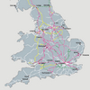
The report, written by the Hyder Consulting Group, dated 2010 and titled Network Resilience and Adaptation, assesses and details in great depth the vulnerability and resilience of the transport infrastructure in the East of England. And it uses me as a reference.

Posted in REPORTS and WHITEPAPERS
Tags: , , , ,

Book Review: The Geography of Transport Systems

This book will fascinate, because it so brilliantly explains, explores, researches and reviews the spatial impact of transportation systems and how they have shaped the world that surrounds us.

Posted in BOOKS and BOOK CHAPTERS
Tags: , , , , , , , ,

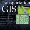
Book Review: Transportation GIS

This book showcases many examples of how GIS can be applied in the field of transportation using ArcView GIS, but it doesn’t come with any theory. Unfortunately is is more like an overpriced ESRI sales brochure and not a textbook.

Posted in BOOKS and BOOK CHAPTERS
Tags: , , , ,

Book review: GIS for Transportation

Mind you, this book is not for the fainthearted, this is solid academic work and specked with references that are hard to get, and you are likely to spend more time in the library reading up on the bibliography than digesting the actual text.

Posted in BOOKS and BOOK CHAPTERS
Tags: , , , , ,

ArcView Network Analyst Tutorial

This tutorial was developed by Jan Husdal at the University of Utah, Salt Lake City, 2000-2002. It shows how to solve 3 categories of network analysis problems; Find Best Route, Find Closest Facility and Find Service Area, and it comes complete with exercise data and solutions.

Posted in THIS and THAT
Tags: , , ,

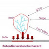
JavalancheTM – analyzing hazards to roads

Traditionally, in studying the effect of hazards on roads, a hazard map is prepared based on the hazard in question, the contributing factors and then overlaid with a road map. If the road or a buffer around its vicinity intersects hazard areas, these areas constitute a potential threat. In the approach used in this procedure, imagine traveling along the road and looking to either side for hazards.

Posted in THIS and THAT
Tags: , , ,

Shortest Path Computation: A Comparative Analysis

Current research work into establishing a performance efficiency hierarchy between Java, C++ and ArcView is described and experimentation is performed in order to statistically compare shortest path query execution time, response time and implementation issues.

Posted in my PUBLIC PRESENCE
Tags: , , , , , , , ,

A spatial framework for modeling hazards to transportation lifelines

Transportation networks are exposed to a wide range of natural hazards and this study has developed a GIS tool for analyzing these hazards. The primary hazards included in this study are avalanches, landslides, flooding, earthquakes, wildfires, and rockfall. The GIS software used was MFWorks

Posted in my PUBLIC PRESENCE
Tags: , , ,

Issues in visualization of risk and vulnerability

Visualization technology has emerged as a form of exploratory cartography, which can help explain, analyze and communicate risk.

Posted in THIS and THAT
Tags: , , , , , ,

MFworks Tutorial

This tutorial, developed in 2002, is a showcase on network analysis in MFworks, with step by step instructions and a summary of the theory behind it.

Posted in THIS and THAT
Tags: , , , , , ,

The use of air photos in emergency management

Air photos can capture a lot more information than field surveys can, and can assist in a number of situations. Air photos are a tool which should not be left out in any form of emergency management.

Posted in THIS and THAT
Tags: , ,

How to make a straight line square

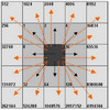
Traditionally, network analysis, path finding and route planning have been the domain of graph theory and vector GIS, which is where most algorithms find their application. Contrary to such common wisdom, the research of this thesis for the Msc in GIS explores the topic of network analysis in raster GIS, using MFworks as example software.

Posted in my PUBLIC PRESENCE
Tags: , , , , , , ,

Fastest path problems in dynamic transportation networks

This research essay and literature review investigates some of the gateways to path finding in static and dynamic networks that are listed in present research literature. A selected set of different approaches are highlighted and set in a broader context, illustrating the various aspects of path finding in static and dynamic networks.

Posted in THIS and THAT
Tags: , , , , , , , ,

Book Review: This is where raster GIS started…

Tomlin is a must to any academic student of GIS, since much or nearly all work on raster GIS springs off from Tomlin’s work….well not really, but Geographic Information Systems and Cartographic Modeling by Tomlin sparked the scientific interest in it.

Posted in BOOKS and BOOK CHAPTERS
Tags: , , , ,

ERDAS tutorial

This tutorial is taken from my coursework for the MSc in GIS at the University of Leicester, 1999-2000, and is hopefully of use to other students.

Posted in THIS and THAT
Tags: , ,

How to use IDRISI GIS

This paper was written in 1999 as part of my coursework for the MSc in GIS at the University of Leicester, UK. Later revised in 2002 and 2008

Posted in THIS and THAT
Tags: , ,

Road Transportation Management using GIS – vehicle routing and tracking

Roads are main arteries of modern society’s infrastructure, contributing heavily to the distribution of goods and persons. GIS provides many helpful applications for ensuring a smooth flow, by aiding design, routing, traffic control and real-time navigation.

Posted in THIS and THAT
Tags: , , , , , ,

Network analysis – raster versus vector – A comparison

The key to producing successful network models is in understanding the relationship between the characteristics of physical network systems and the representation of those characteristics by the elements of the network model.

Posted in THIS and THAT
Tags: , , , , , , , ,

ARTICLES and PAPERS
Supply chain agility - Risk mitigation and response
How does company culture shape a firm's risk mitigation and response, and thus, how does company cul[...]
Transportation Lifelines and Critical Infrastructure
This is the first paper that sparked my research interest in transportation vulnerability, and what [...]
BOOKS and BOOK CHAPTERS
Enterprise-wide Risk Management
Coming from a crisis management and business continuity background, I really enjoyed reading Enterpr[...]
Book Review:Managing Risks in Supply Chains
To make up for yesterday's perhaps overly harsh critique of just one article from this book, this is[...]
REPORTS and WHITEPAPERS
Saving Norway's crumbling infrastructure
NTP 2010-2019
Following up my post this morning called "D-Day for Norway's Transport Infrastructure", the numbers [...]
When disaster strikes...
...how does the transportation network recover? And why are transportation networks so essential to [...]
from HERE and THERE
Supply chains compete, not companies
"Supply chains compete, not companies" is the motto on Martin Christopher's web site, www.martin-chr[...]
ArcView Network Analyst Tutorial
The ArcView Network Analyst (AVNA is extension module for ArcView GIS. This tutorial was developed b[...]