About the tutorial
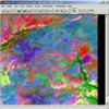 This tutorial is taken from my coursework for the MSc in GIS at the University of Leicester, 1999-2000, and is hopefully of use to other students, including students and researchers not at the University Leicester. It is actually not so much a tutorial, but coursework I did for my MSc in GIS. However, it is a good example of what you can do with ERDAS.
Contents
1:Introduction
2:Viewing and Investigating
3:Greyscale decorrelation and edge enhancements
4:Band ratio
5:Principal components versus Tesseled cap
6:Geometric and radiometric correction
7:Supervised and unsupervised Classification
Get started
Click here for the ERDAS tutorial

