Transportation networks are exposed to a wide range of natural hazards and this study has developed a GIS tool for analyzing these hazards. The primary hazards included in this study are avalanches, landslides, flooding, earthquakes, wildfires, and rockfall. Although the primary focus of this research is roads, it is equally applicable to other transportation lifelines, such as railways, canals/waterways, or transmission lines for power, gas or oil. This presentation provides an overview of the spatial framework, current results and limitations, and directions for further research. MFworks was used as a GIS tool, along with a self-developed Java application.
Javalanche
While MFworks was used as a GIS tool, the analysis and delineation of avalanche basins was done using Javalanche, a Java application developed for this purpose.
Slides
The slides below were presented at the AAG Annual Meeting, Los Angeles, 19-23 March 2002. The idea behind the research which was part of my (now discontinued) PhD in Geography was to develop a new spatial framework for modeling hazards to transportation lifelines. MFworks was used as GIS software.
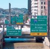
 The traditional approach uses a buffer for overlay/intersection. This research uses a neighbourhood search function. The case study was done for avalanches onto roads in Little and Big Cottonwood Canyon in Utah. The method can also be applied to other spatial hazards, such as wildfire or rockfall.
 The study is part of a larger research project undertaken by the National Consortium for Remote Sensing in Transportation, and the focus is to develop analytical tools and methods that can be uniformly applied to identify, map and assess a variety of hazards to transportation systems.
 The traditional method for assessing spatial hazards to roads involves overlaying map layers for intersection, or by creating a buffer. However, this does not take into account the specific characteristics of the hazard, it may also lead to over- or underestimation, it does not take into account the impact on the road.
 Our method uses the notion of object fields, where every location along atransportation network has a potential spill plume or watershed.
 The method searches the neighbourhood from a given location and generates the watershed during the search, thus defining the area that impacts the given location.
 For avalanches, the method uses the slope as the main parameter.
 The avalanche basin is found by using Landsat TM data, along with USGS DEM and USGS DOQ.

The procedure is as follows: 1) For every cell along the road, determine all upstream cells that make out a basin adjacent to the road or adjacent to a buffer a ceratin distance from the road. 2) For every basin, determine the amount of avalanche threat based on slope, vegetation and other contributing factors within the basin. 3) For every basin, determine the stretch of road the particular basin effects. 4) For every affected stretch of road, determine the threat potential based on the amount of threat in the basin that is linked to this particular stretch of road.
 Input: Road layer, DEM layer, NDVI layer.
 Step 1: Calculate avalanche runout basins.
 Step 2: Calculate risk in non-vegetated areas.
 Calculate runout.
 Result: Road segments affected by avalanches.
 This method can be applied to other hazards., e.g. wildfires: Backtracking the spread of fire towards the road. How long will it take for a wildfire to reach the road?
 This method can be applied to other hazards., e.g. roackfall: Defining runout zones from given or likely starting points.
 Conclusion: The neighborhood search is a feasible alternative to the traditional buffer/intersection approach. It uses a variably shaped neighborhood instead of a fixed-shaped buffer. The neighborhood is delineated by hazrad parameters and environmental parameters, and delineates the exact stretch of road that is affected. It can be applied to a variety of hazards and a variety of infrastructure objects.
 However, there are some issues: There may not be suffcient data available for each type of hazard. Remotely sensed data may not have the scale required. And hazard and/or neighborhood parameter estimation is largely based on expert judgement.

Reference
Husdal, J. (2002) A spatial framework for modeling hazards to transportation lifelines. presented at the AAG Annual Meeting, Los Angeles, 19-23 March 2002.
Related
- husdal.com: The reliability and vulnerability of transportation lifelines
- husdal.com: Javalanche