Latest posts

Reliability and vulnerability in road development projects

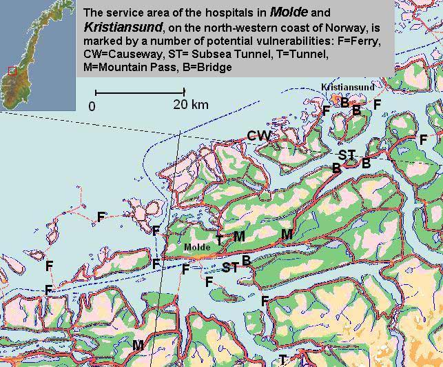
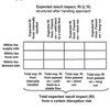
Why is the reliability, or conversely, the vulnerability, of the transportation network not a matter of evaluation in traditional cost-benefit analyses? Few will question that the sender, the recipient, the freight hauler or society in general, experience additional costs when goods or persons cannot reach their destinations in time or space.

Posted in my PUBLIC PRESENCE


Pålitelighet og sårbarhet – et ikke-tema i nyttekostnadsanalyser?

Pålitelighet og sårbarhet er to forhold av betydning for transportbrukere som i dag ikke tas hensyn til i vurdering av samferdselsprosjekter. Hvorfor er slike vurderinger ikke med når vegprosjekter blir vurdert?

Posted in my PUBLIC PRESENCE


Book review: Cost-Benefit Analysis: Theory and Application

I used this book to learn more about cost-benefit analysis (CBA) in tranportation planning, and albeit the book does not relate specifically to that field, it worked very well. The nice part is that it first discusses some macro-economical concepts before delving into cost-benefit calculations.

Posted in BOOKS and BOOK CHAPTERS


Book Review: Transportation Network Analysis

Drawing heavily on academic knowledge this book almost requires a degree in civil engineering before you even start reading. This is a book for the expert rather than the novice.

Posted in BOOKS and BOOK CHAPTERS


Book review: GIS for Transportation

Mind you, this book is not for the fainthearted, this is solid academic work and specked with references that are hard to get, and you are likely to spend more time in the library reading up on the bibliography than digesting the actual text.

Posted in BOOKS and BOOK CHAPTERS


ArcView Network Analyst Tutorial

This tutorial was developed by Jan Husdal at the University of Utah, Salt Lake City, 2000-2002. It shows how to solve 3 categories of network analysis problems; Find Best Route, Find Closest Facility and Find Service Area, and it comes complete with exercise data and solutions.

Posted in THIS and THAT


Pålitelighet og sårbarhet av transportsystemer

Transportsystemer som veg og jernbane danner ryggraden i et moderne samfunn. Påliteligheten og sårbarheten i et transportsystem blir dermed avgjørende faktorer ikke bare i konkurranse- og markedsøyemed, men også i beredskapssammenheng, for å kunne opprettholde normal samfunnsdrift.

Posted in THIS and THAT


The reliability and vulnerability of transportation lifelines

Transportation networks like freeways and interstate highways are the main backbone of modern society. Consequently, the reliability or vulnerability of any transportation network is thus a decisive factor not only in terms of market outreach and competition, but also in terms of continuity, to ensure a 24/7 operation of the community we live in.

Posted in THIS and THAT


JavalancheTM – analyzing hazards to roads

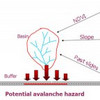
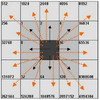
Traditionally, in studying the effect of hazards on roads, a hazard map is prepared based on the hazard in question, the contributing factors and then overlaid with a road map. If the road or a buffer around its vicinity intersects hazard areas, these areas constitute a potential threat. In the approach used in this procedure, imagine traveling along the road and looking to either side for hazards.

Posted in THIS and THAT


Shortest Path Computation: A Comparative Analysis

Current research work into establishing a performance efficiency hierarchy between Java, C++ and ArcView is described and experimentation is performed in order to statistically compare shortest path query execution time, response time and implementation issues.

Posted in my PUBLIC PRESENCE


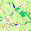
A spatial framework for modeling hazards to transportation lifelines

Transportation networks are exposed to a wide range of natural hazards and this study has developed a GIS tool for analyzing these hazards. The primary hazards included in this study are avalanches, landslides, flooding, earthquakes, wildfires, and rockfall. The GIS software used was MFWorks

Posted in my PUBLIC PRESENCE


Book review: Networks and Algorithms

This book tells you the difference between the various types of graphs, trees and networks and shows you step by step calculations on how to solve them by hand (they didn’t have that many computers in 1993).

Posted in BOOKS and BOOK CHAPTERS


Issues in visualization of risk and vulnerability

Visualization technology has emerged as a form of exploratory cartography, which can help explain, analyze and communicate risk.

Posted in THIS and THAT


MFworks Tutorial

This tutorial, developed in 2002, is a showcase on network analysis in MFworks, with step by step instructions and a summary of the theory behind it.

Posted in THIS and THAT


Corridor Analysis – A timeline of evolutionary development

corridor-modellingLocating a right-of-way for a linear facility such as a pipeline, a transmission line, a railway or a roadway can be a complex problem. Locating a corridor connecting an origin and a destination on a landscape is analogous to identifying a route that traverses a continuous landscape. Thus, corridor analysis is closely linked to shortest-path finding and network analysis in raster GIS, and has evolved along with it. Corridor analysis is essentially a variant of surface analysis, but can also be viewed as a site selection problem where an optimal contiguous and elongated site is sought.

My PhD?

On a sidenote, I should mention that since this post was first published,

Read more

Posted in ARTICLES and PAPERS


The use of air photos in emergency management

Air photos can capture a lot more information than field surveys can, and can assist in a number of situations. Air photos are a tool which should not be left out in any form of emergency management.

Posted in THIS and THAT


How to make a straight line square

Traditionally, network analysis, path finding and route planning have been the domain of graph theory and vector GIS, which is where most algorithms find their application. Contrary to such common wisdom, the research of this thesis for the Msc in GIS explores the topic of network analysis in raster GIS, using MFworks as example software.

Posted in my PUBLIC PRESENCE


Fastest path problems in dynamic transportation networks

This research essay and literature review investigates some of the gateways to path finding in static and dynamic networks that are listed in present research literature. A selected set of different approaches are highlighted and set in a broader context, illustrating the various aspects of path finding in static and dynamic networks.

Posted in THIS and THAT


Book Review: This is where raster GIS started…

Tomlin is a must to any academic student of GIS, since much or nearly all work on raster GIS springs off from Tomlin’s work….well not really, but Geographic Information Systems and Cartographic Modeling by Tomlin sparked the scientific interest in it.

Posted in BOOKS and BOOK CHAPTERS


ERDAS tutorial

This tutorial is taken from my coursework for the MSc in GIS at the University of Leicester, 1999-2000, and is hopefully of use to other students.

Posted in THIS and THAT


ARTICLES and PAPERS
Humanitarian aid is better when decentralized
Humanitarian operations rely heavily on logistics in uncertain, risky, and urgent contexts, making t[...]
Rigorous Risk Management
As a global management consulting firm, A.T. Kearney is focusing on strategic and operational CEO-ag[...]
BOOKS and BOOK CHAPTERS
Book Review: Transportation Security
Instead of Transportation Systems Security, which I reviewed in an earlier post, I should have settl[...]
Organizing Resilience
Resilience. A word that his been in the media perhaps more than ever before these days. I am of cour[...]
REPORTS and WHITEPAPERS
A Decade of Living Dangerously
Do you remember the movie The Year of Living Dangerously with Mel Gibson? Topically unrelated maybe,[...]
Assess the vulnerability of your production system
So far I have reviewed "international" literature and web sites, and it is only fitting that now it [...]