Blog Archives

The use of Geographical Information Systems in Transportation

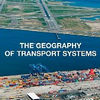
Book Review: The Geography of Transport Systems

This book will fascinate, because it so brilliantly explains, explores, researches and reviews the spatial impact of transportation systems and how they have shaped the world that surrounds us.

Posted in BOOKS and BOOK CHAPTERS
Tags: , , , , , , , ,

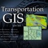
Book Review: Transportation GIS

This book showcases many examples of how GIS can be applied in the field of transportation using ArcView GIS, but it doesn’t come with any theory. Unfortunately is is more like an overpriced ESRI sales brochure and not a textbook.

Posted in BOOKS and BOOK CHAPTERS
Tags: , , , ,

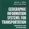
Book review: GIS for Transportation

Mind you, this book is not for the fainthearted, this is solid academic work and specked with references that are hard to get, and you are likely to spend more time in the library reading up on the bibliography than digesting the actual text.

Posted in BOOKS and BOOK CHAPTERS
Tags: , , , , ,

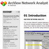
ArcView Network Analyst Tutorial

This tutorial was developed by Jan Husdal at the University of Utah, Salt Lake City, 2000-2002. It shows how to solve 3 categories of network analysis problems; Find Best Route, Find Closest Facility and Find Service Area, and it comes complete with exercise data and solutions.

Posted in THIS and THAT
Tags: , , ,

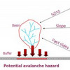
JavalancheTM – analyzing hazards to roads

Traditionally, in studying the effect of hazards on roads, a hazard map is prepared based on the hazard in question, the contributing factors and then overlaid with a road map. If the road or a buffer around its vicinity intersects hazard areas, these areas constitute a potential threat. In the approach used in this procedure, imagine traveling along the road and looking to either side for hazards.

Posted in THIS and THAT
Tags: , , ,

Road Transportation Management using GIS – vehicle routing and tracking

Roads are main arteries of modern society’s infrastructure, contributing heavily to the distribution of goods and persons. GIS provides many helpful applications for ensuring a smooth flow, by aiding design, routing, traffic control and real-time navigation.

Posted in THIS and THAT
Tags: , , , , , ,

ARTICLES and PAPERS
Supply chain vulnerability: Mitigation strategies
A new outlet for articles on supply chain vulnerability? Perhaps. And actually, it's not that new, s[...]
Building a secure and resilient supply chain
Are you gambling with your supply network? You should be aware that the supply network is inherently[...]
BOOKS and BOOK CHAPTERS
Book Review: HBR on Supply Chain Management
Today we continue my exploration of the Harvard Business Review Paperback Series that I started yes[...]
Low Cost Country Sourcing
Low-cost countries. A dream for some and a nightmare for other others. What are typical supply chain[...]
REPORTS and WHITEPAPERS
America’s Crumbling Infrastructure
My daily morning routine includes a cup of coffee while watching the World Business Report on BBC Wo[...]
Calculating the Value-at-Risk
Some of you may remember that I posted about the SCOR Framework for Supply Chain Risk Management ear[...]
from HERE and THERE
Should you join the Supply Chain Network SCN?
I joined SCN two days ago, and it has been very rewarding so far. The Supply Chain Network SCN marke[...]
Sparse transportation networks and disruptions
The vulnerability of the transportation network as part of the supply chain is of particular interes[...]